

Overview
The Spatial Process tool converts polygons to and from the data that describe them: points, lat/lon or x/y pairs, or line segments. Use this tool to convert polygon data to or from "flat" formats like TIGER or polygon spatial data formats that can be processed with tools like Spatial Join or functions like Centroid.
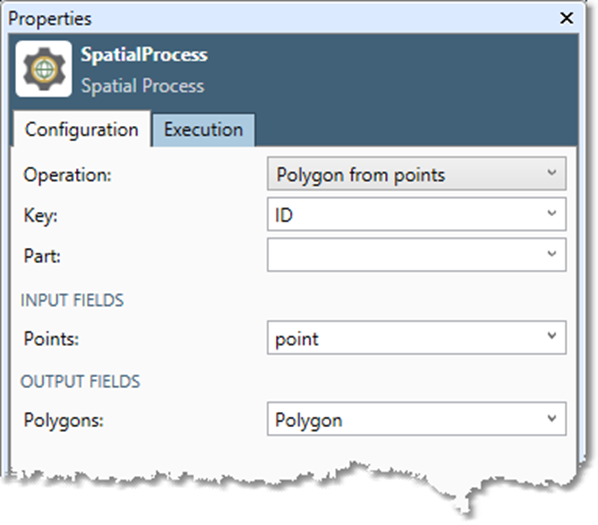
Spatial Process tool configuration parameters
The Spatial Process tool has a single set of configuration parameters in addition to the standard execution options.
|
Parameter |
Description |
|---|---|
|
Operation |
Select the desired operation. This is optional and defaults to Polygon from points. |
|
Key |
The field that identifies which records go together. All adjacent records with the same Key value are combined into a single polygon. |
|
Output closing point |
Select to replicate the first point of each polygon to the end when Operation is Polygons to points, Polygons to lat/lon, or Polygons to X/Y. |
|
Part |
The field containing the part number for multi-part items. |
|
Input fields
|
Depending on the Operation specified, can be a single Points field, Latitude and Longitude fields, X and Y coordinate fields, segment Start point and End point fields, or a Polygon field. Spatial file formats cannot be saved to or read from the Data Management Repository. |
Configure the Spatial Process tool
-
Select the Spatial Process tool.
-
Go to the Configuration tab.
-
Select the desired spatial Operation.
|
Parameter |
Description |
|---|---|
|
Polygon from points |
Input a series of records with spatial point data and create a series of polygons by combining all of the points for records with the same Key value. |
|
Polygon from lat/lon |
Input a series of records with latitude/longitude numbers and create a series of polygons by combining all of the latitude/longitude values for records with the same Key value. |
|
Polygon from X/Y |
Input a series of records with x/y values and create polygons by associating x/y pairs with the same Key value into polygons. |
|
Polygon from segments |
Input a series of records with line segments (point pairs) and create polygons by chaining up the segments end-to-end until a single chain is formed for each Key value. |
|
Polygon/polyline to points |
Input a series of records with polygons and decompose each one into a series of Point spatial objects. |
|
Polygon/polyline to lat/lon |
Input a series of records with polygons and decompose each one into a series of lat/lon values. |
|
Polygon/polyline to X/Y |
Input a series of records with polygons and decompose each one into a series of x/y values. |
|
Polygon/polyline to segments |
Input a series of records with polygons and decompose each one into a series of line segments (point pairs), where the line segments, if connected end-to-end, recreate the polygons. |
-
Select the Key. This field identifies which records go together—all adjacent records with the same Key value are combined into a single polygon.
-
Optionally, select Output closing point to replicate the first point of each polygon to the end. Applies only to Polygons to points, Polygons to lat/lon, and Polygons to X/Y.
-
Optionally, select the field containing the Part number for multi-part items. If the operation is...
|
Field |
Description |
|---|---|
|
Polygon/polyline to points
|
Part contains the sequence number of the "ring" of the polygon or the "segment" of the polyline. Numbering starts at zero. |
|
Polygon from points
|
Part contains the input ring number. If not specified, it is assumed that there is one ring per polygon. |
|
Polyline from points
|
Part contains the input segment number. If not specified, it is assumed that there is one segment per polyline. |
-
Select the Input fields. Depending on the Operation you specified in step 2, this can be a single Points field, Latitude and Longitude fields, X and Y coordinate fields, segment Start point and End point fields, or a Polygon field.
-
Select the Output fields. Depending on the Operation you specified in step 2, this can be a single Points field, Latitude and Longitude fields, X and Y coordinate fields, segment Start point and End point fields, or a Polygon field.
-
Optionally, go to the Execution tab, and then set Web service options.