

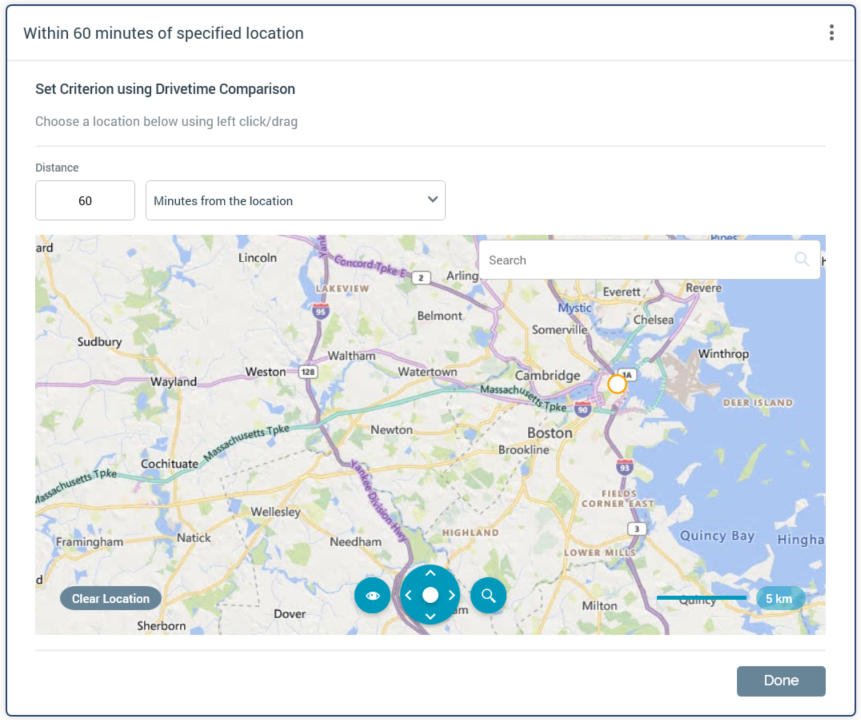
The Drivetime Geolocation allows you to make Realtime decisions on the basis of a visitor's proximity (in distance or time) from a given geographical location. The criterion editor uses a map. The default location displayed in the criterion editor’s map is controlled by user preference Realtime Decision Default Map Location.
When in edit mode, the following is presented at a Drivetime criterion:
-
Distance: this mandatory integer property accepts a value between 0 and 999,999
-
[Dropdown]: the accompanying dropdown allows you to specify the type of proximity to be used, by selecting one of the following values:
-
Miles from the location
-
Kilometers from the location
-
Minutes from the location (the default)
-
-
Search: you can search the map for a location. Having entered a search string and selected the button, search results are shown when multiple exist:
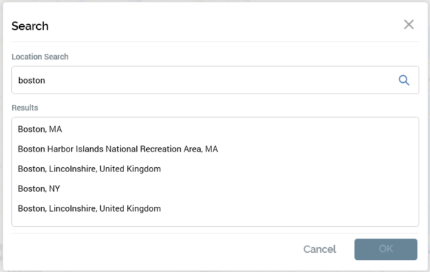
You can select a location to proceed, or select Close or Cancel to remove the search results from display.
-
Clear Location: this button is enabled when a location has been added to the map. Selecting it removes the specified location.
-
Map: a world map allows you to choose the location upon which the criterion is to be based. The following are shown at the bottom of the map:
-
View: allows you to display the map in Road (the default) or Aerial View.
-
Show Labels: this toggle button is enabled when Aerial View is selected. It is selected by default when enabled.
-
Map Navigator: facilitates scrolling around the map.
-
Zoom: you can zoom the map using a slider control, or by selecting one of the options to the right (Neighborhood, City, Region, State or World).
-
Scale: read-only.
-
You can select the map to add a location. Having done so, you can select the Clear Location button to remove your selection, or drag the location to move it. Note that it is mandatory to specify a location.
When in read-only mode, a drivetime location is shown as e.g.:
