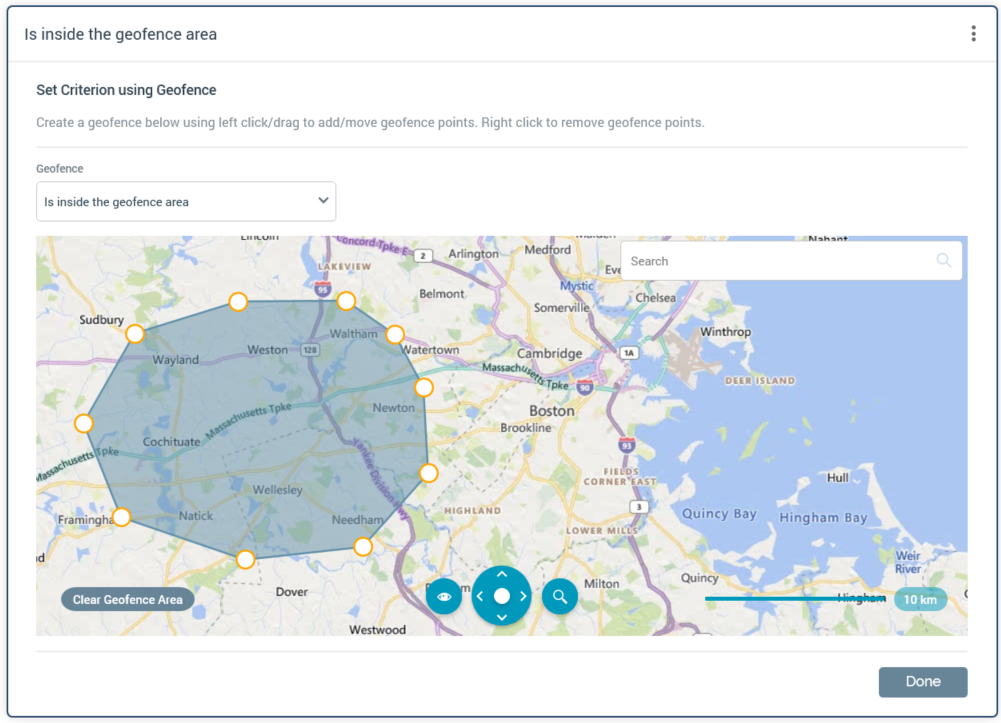
The Geofence Geolocation allows you to make Realtime decisions on the basis of a visitor's relationship to a Geofence area. The default location displayed in the criterion editor’s map is controlled by user preference Realtime Decision Default Map Location.
When in edit mode, the following is presented at a Geofence criterion:

-
Geofence: allows you to specify the nature of a visitor's relationship to the geofence. The following values are supported:
-
Is inside the geofence area (the default)
-
Is outside the geofence area and within
-
Is inside the geofence area, or outside and within
-
Is outside the geofence area
-
-
[n]: this mandatory integer property is shown if [Dropdown] is set to one of “Is outside the geofence area, within” or “Is inside the geofence area, or within”. It defaults to 50, and accepts a minimum value of 1 and a maximum value of 500.
-
[units]: this dropdown property is displayed if [Dropdown] is set to one of “Is outside the geofence area and within” or “Is inside the geofence area, or outside and within”. It exposes the values meters of boundary (the default) and yards of boundary.
-
Search: see the Drivetime criterion for details.
-
Clear Geofence Area: this button is enabled when a geofence has been added to the map. Clicking it removes the geofence.
-
Map: you can create a geofence polygon by clicking positions on the map. Each click adds a geofence point. A geofence is created when at least three points have been added. You can drag a geofence point to move it, or right click it to remove it. It is mandatory to add a geofence.
Further information on using the map control can be found in the Drivetime Geolocation decision criterion documentation.
When in read-only mode, a geofence criterion is displayed as per the following examples:

Note that the geofence criterion is only supported when using the Azure geolocation provider.

